
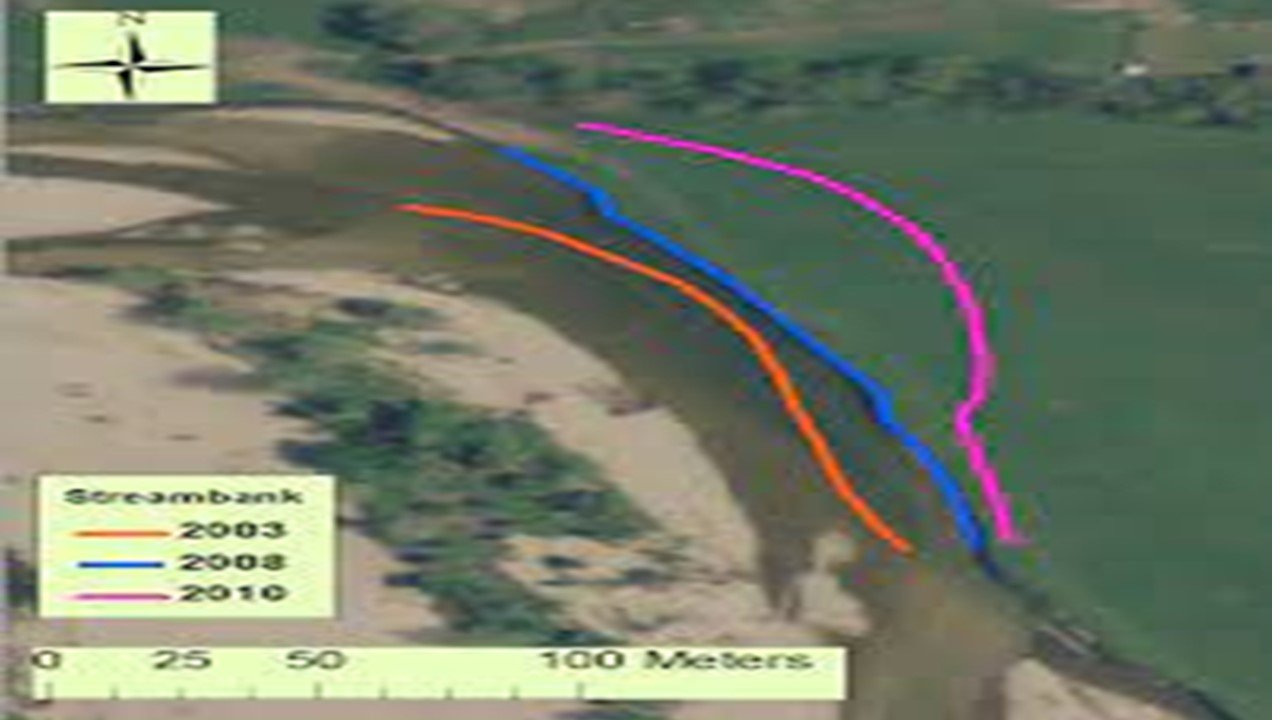
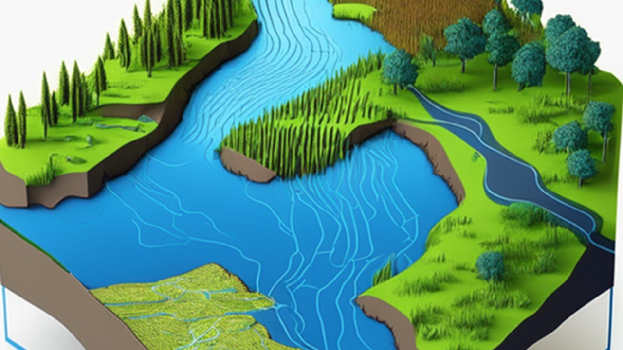
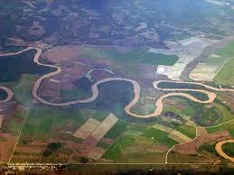
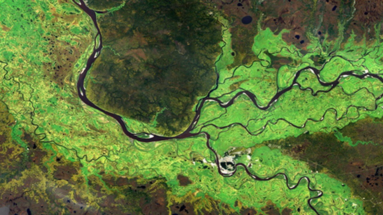
Rivers and streams
Remote Sensing & GIS play a crucial role in rivers and streams by providing spatial data for mapping, monitoring, and analysing water quality, flow patterns, and ecological changes, aiding in effective management and conservation efforts.
- River corridor mapping
- Flood risk mapping
- Aquatic vegetation mapping
- Aquatic vegetation mapping
- Stream flow monitoring
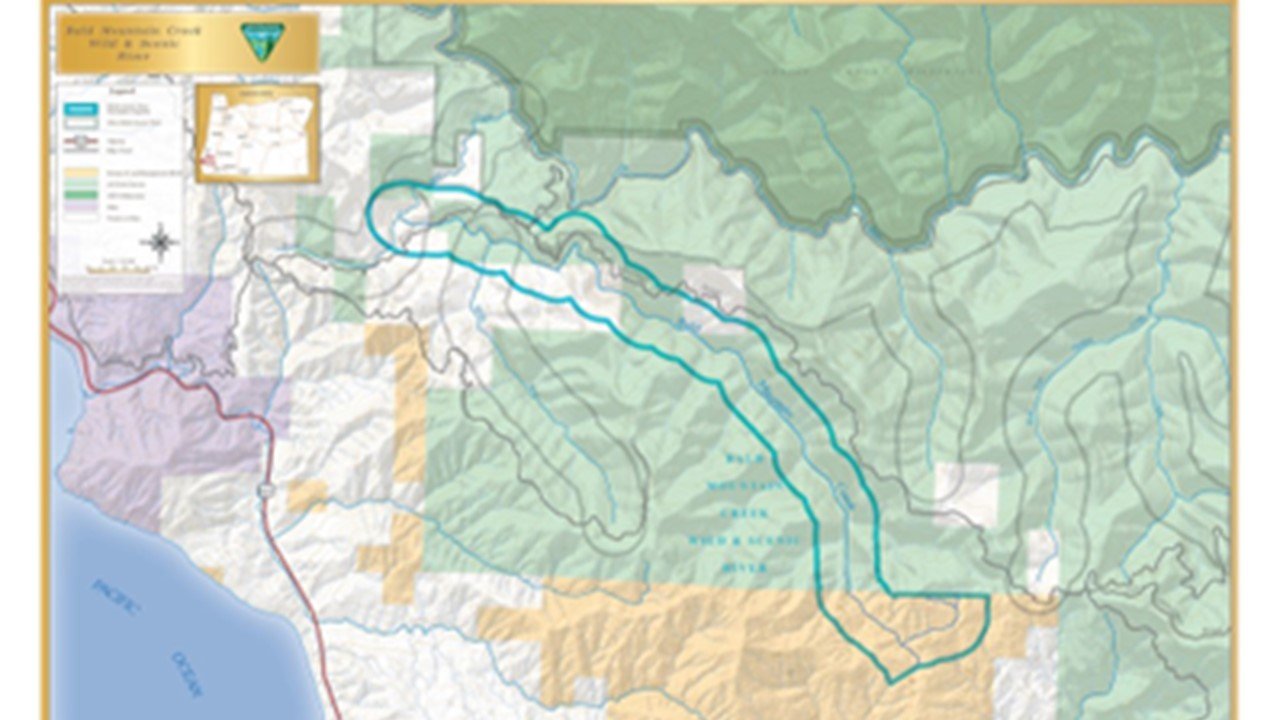
For the management and monitoring of rivers and streams, remote sensing and GIS are essential. It provides detailed data on river morphology, water quality, and vegetation through satellite imagery and aerial photography. GIS integration enables informed decision-making, flood mapping, habitat assessment, and river restoration planning. This combination enhances understanding, conservation, and sustainable management of these crucial water resources.
Dams and Barrages
Remote Sensing & GIS are essential in dams and barrages for monitoring water levels, land cover changes, and assessing the impact of reservoir operations, facilitating efficient water resource management and safety protocols.
- Reservoir mapping
- Dam safety monitoring
- Sedimentation mapping
- Dam deformation monitoring
- Water level monitoring
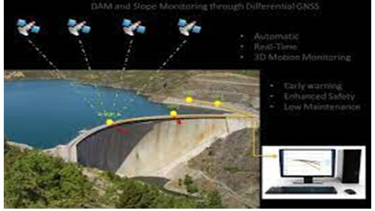
GIS and remote sensing are essential for the effective management and oversight of dams and barrages. Satellite imaging and aerial photography offers useful information about the area around the dam, the state of the reservoir, and the land use. In order to improve decision-making, risk assessment, flood modelling, and reservoir management, GIS enables integrated analysis, ultimately boosting sustainability and safety.
Bridges
Remote Sensing & GIS are important in bridges for assessing terrain characteristics, identifying potential hazards, and aiding in the planning, design, and maintenance of bridges for optimal safety and performance.
- Bridge inventory mapping
- Bridge condition assessment using imagery
- Bridge clearance mapping
- Bridge deformation monitoring
- Bridge load capacity analysis
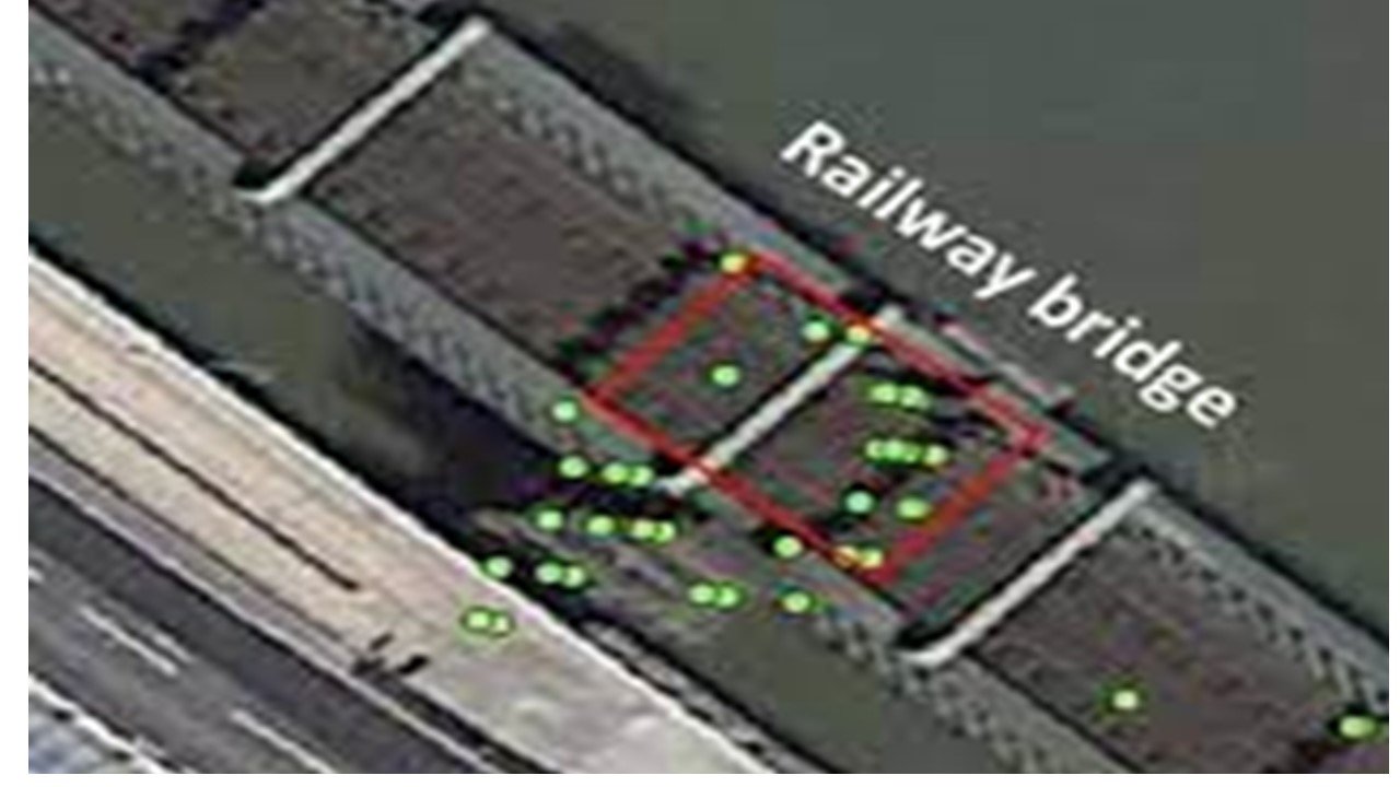
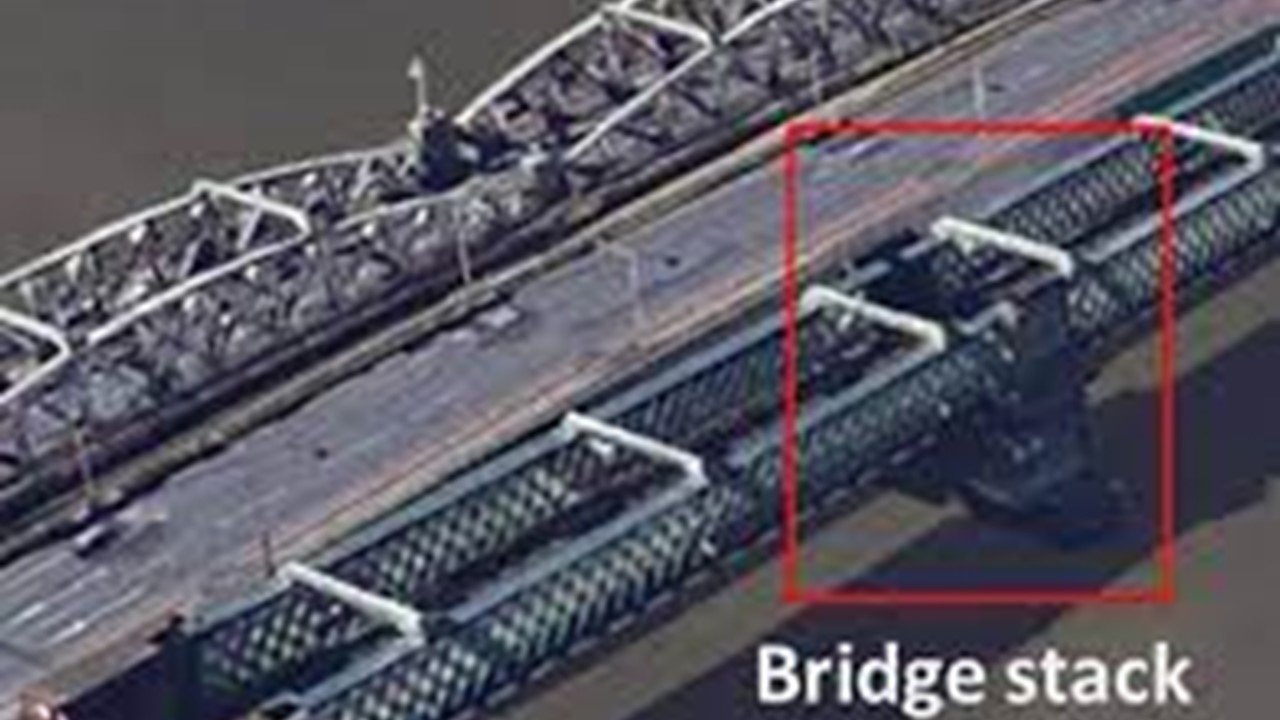
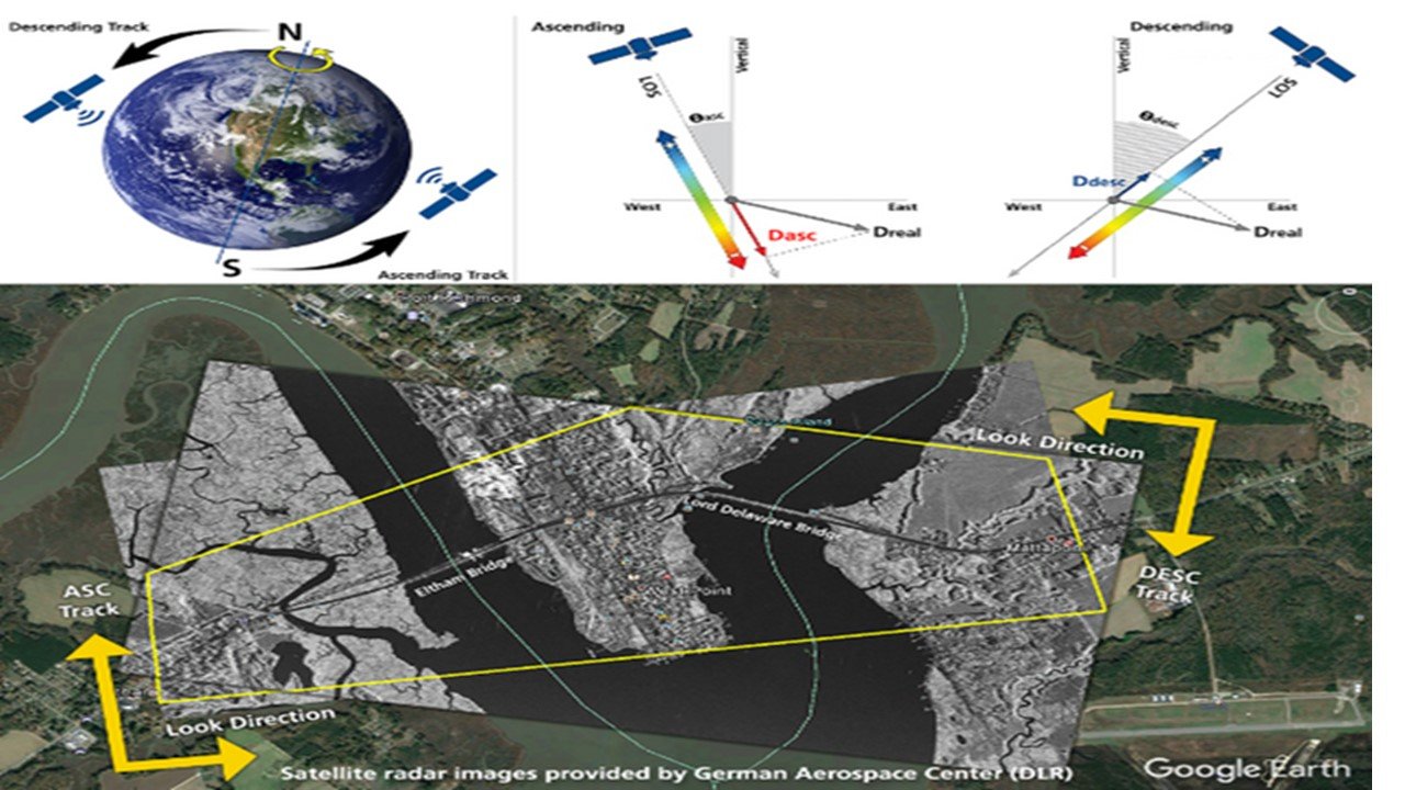
GIS and remote sensing are crucial for managing and monitoring bridges and providing useful data for decision-making. Remote sensing provides in-depth information on the state of bridges and their surroundings using satellite imagery and aerial photography. Integration and analysis of these data are made possible by GIS, which enhances structural assessment, risk analysis, and maintenance planning. Understanding, safety, and longevity of bridges are all improved by the use of remote sensing and GIS.
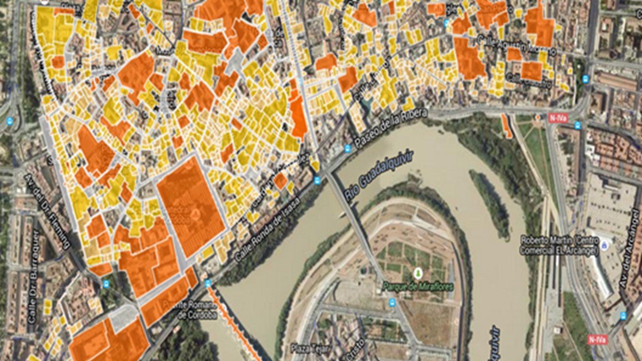
Urban Planning
Remote Sensing & GIS are vital in urban planning by providing accurate spatial data for land-use mapping, infrastructure planning, and environmental assessment, facilitating informed decision-making and sustainable development.
- Land use mapping
- Zoning mapping
- Urban growth modelling
- Energy efficiency mapping
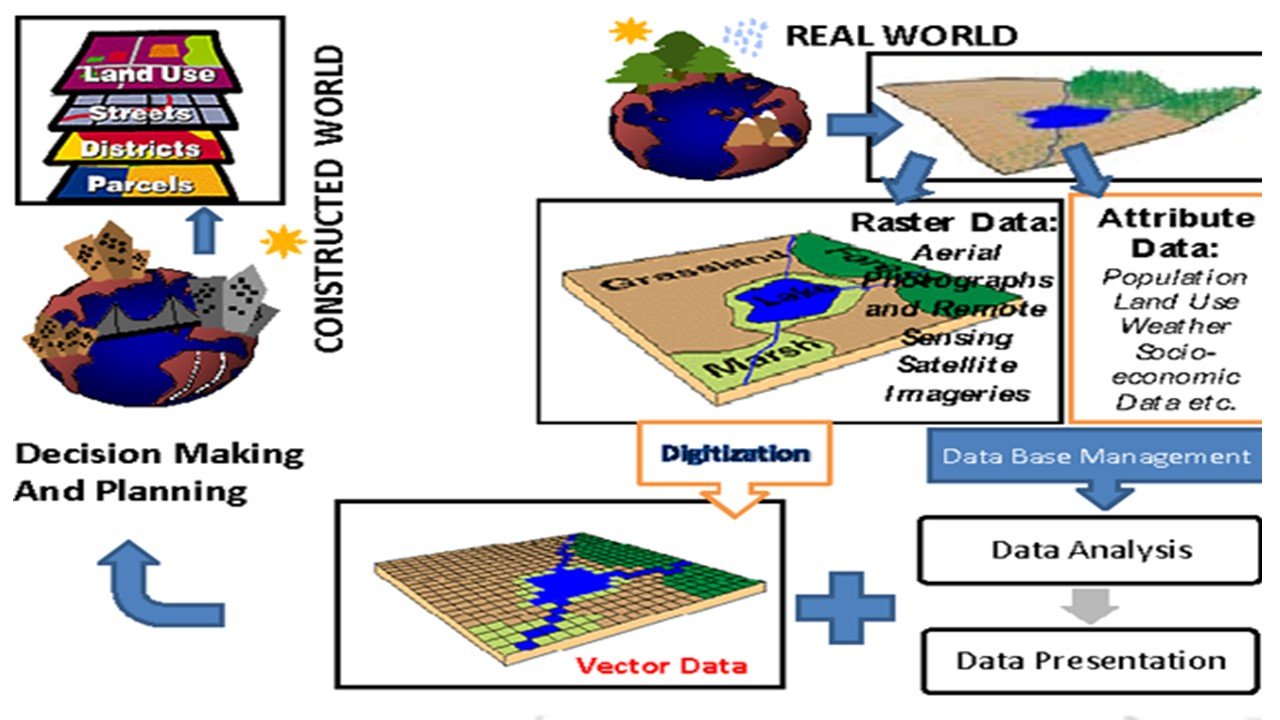
GIS and remote sensing are essential for efficient urban planning offering useful information and resources. Remote sensing delivers thorough information on land use, infrastructure, and the environment through satellite imaging and aerial photography. This spatial data may be integrated and analysed using GIS, leading to better resource allocation, infrastructure management, and urban planning. Remote sensing and GIS work together to improve urban planning, promoting resource efficiency, sustainable development, and well-informed decision-making.
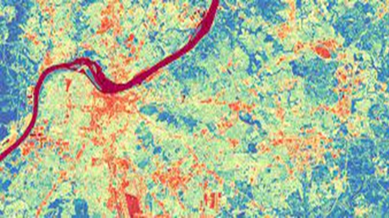
Watershed management
Remote Sensing & GIS play a critical role in watershed management by providing valuable information on land cover, hydrological processes, and land-use changes, aiding in effective planning, conservation, and sustainable use of water resources.
- Watershed boundary mapping
- Soil erosion mapping
- Stream network mapping
- Water quality monitoring
- Watershed modelling
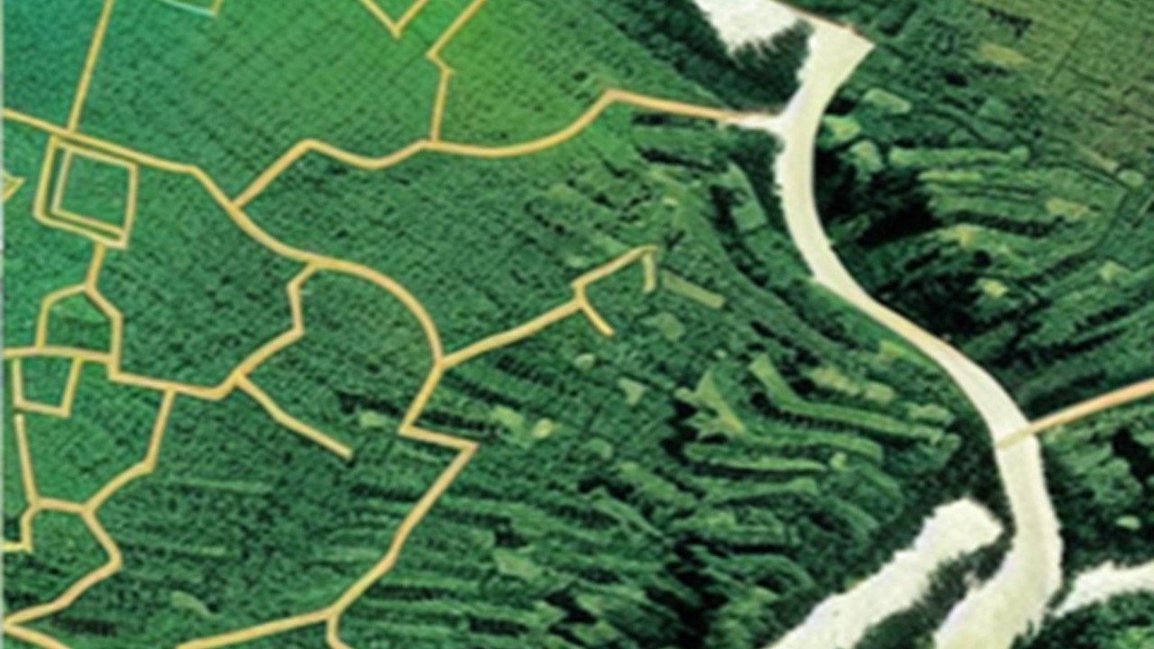
Remote sensing and GIS are essential to watershed management to provide useful information and tools for efficient planning. Aerial and satellite photography offer precise information on ecosystem dynamics, hydrological processes, and land cover. This data may be integrated and analysed using GIS, which improves knowledge of the characteristics of watersheds, water resource management, and environmental planning. Remote sensing and GIS work together to promote conservation efforts in watershed management, monitor changes, and support sustainable practises.
Agriculture
Remote Sensing & GIS are instrumental in agriculture by providing valuable data on crop health, soil moisture, and land-use patterns, enabling precision farming, resource optimization, and informed decision-making for increased productivity and sustainability.
- Irrigation mapping
- Crop health mapping
- Water management using GIS
- Irrigation demand forecasting
- Water use efficiency analysis
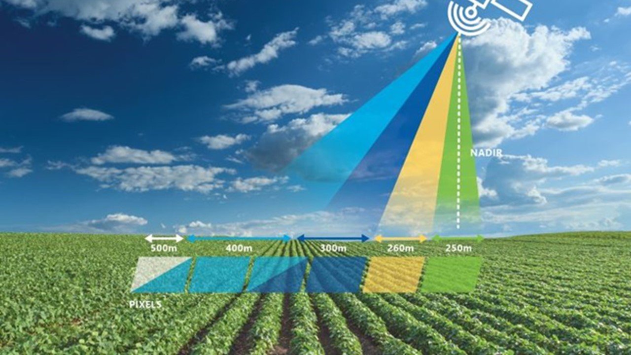
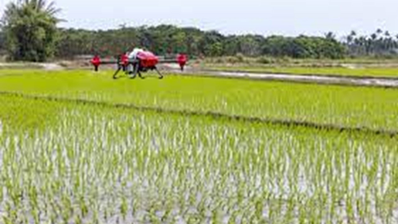

GIS and remote sensing provide useful information and equipment for precision farming. Drones and satellite photos provide comprehensive data on crop health, soil moisture, and vegetation indices. The integration and analysis of this data is made possible by GIS, which improves crop management, yield estimation, and resource optimisation. The integration of remote sensing and GIS promotes productivity gains, sustainable agricultural practises, and well-informed decision-making.
Forests
Remote Sensing & GIS are of utmost importance in forests for monitoring deforestation, assessing biodiversity, and mapping forest cover changes, aiding in effective forest management, conservation, and protection of ecosystems.
- Forest cover mapping
- Forest fire risk mapping
- Forest health monitoring
- Carbon mapping
- Wildlife habitat mapping

GIS and remote sensing are essential for forestry offerring useful information and instruments for efficient forest management. Remote sensing provides thorough information on forest cover, vegetation health, and disturbances using satellite photography and aircraft surveys. This spatial data may be integrated and analysed using GIS, which improves monitoring, biodiversity assessment, and resource planning. Remote sensing and GIS work together to improve forestry practises, aiding conservation initiatives, sustainable management, and well-informed decision-making.