Production of 2D and orthomosaic topographic maps, 3D raster DSM and point clouds with centimeter precision in record time. The Output results are integrated with CAD, GIS and traditional photogrammetry software.
Examples of Use:
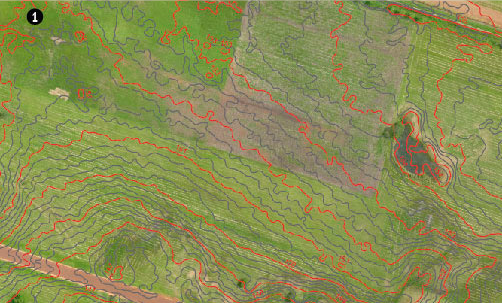
Image 1: Obtaining contour lines from photogrammetric flights
Image 2: Determination of catchment and drainage areas for urban development
The generation of digital elevation models (DEM) to which it is possible to superimpose the terrain images, give a complete idea of the project terrain and facilitate decision-making for designers.
The possibility of making flights on different dates allows you to track the movement of the ground and the progress of the work carried out.
Examples of Use:
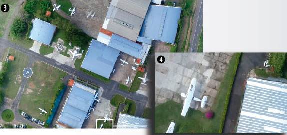
Image 3: Orthomosaic Based On Aerial Photos.
Image 4: Magnification of the indicated area, resolution of 1scm / pixel. Civil works project in central

Image 5: Orthomosaic with resolution of 4 cm / pixel.
Image 6: Digital elevation model of the terrain of the previous sector.
Precision agriculture consists of using new technologies to obtain a detailed study of the crops. The use of drones allows to cover large areas in a short time, in addition to reducing costs, improving the profitability of crops and reducing environmental impact, images can be taken at different dates to see how a crop has changed over time.
The areas of application can be:

Image 8: Determination of the Normalized Vegetation Index (NDVI) from aerial photographs with multispectral cameras.
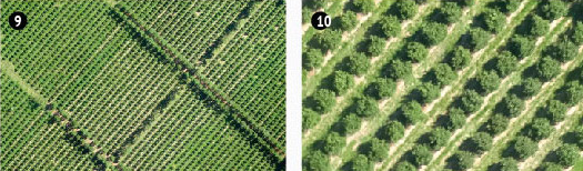
Images 9 and 10: Orthomosaic of the same previous culture and enlarged view with resolution of 5 cm / pixel.
Conservation